"Misinformation Ignites Controversy: The Fallout from Oregon’s Wildfire Risk Map"
Misinformation Fuels Controversy Over Oregon’s Wildfire Hazard Map
Date: October 10, 2023
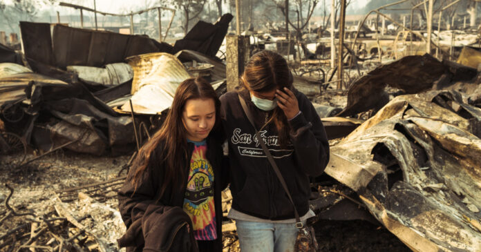
In the wake of Oregon’s most devastating wildfire season in 2020, state lawmakers initiated a significant project aimed at mitigating future risks: a comprehensive wildfire hazard map. This map was designed to assess wildfire risks for every property in the state, a tool intended to guide fire-resistant construction codes and protective measures around homes. However, what began as a proactive safety measure has spiraled into a contentious debate fueled by misinformation, leading to widespread public backlash and legislative repeal.
The Birth of the Wildfire Hazard Map
In 2021, Chris Dunn, a wildfire risk scientist at Oregon State University, was tasked with creating the statewide map. Dunn envisioned Oregon as a national model for wildfire risk adaptation, leveraging the state’s unique land use laws from the late 1960s and 1970s that had successfully curbed urban sprawl. The map was intended to inform homeowners about their wildfire risk and guide them in implementing "defensible space" measures—practices proven to protect homes from wind-driven wildfires.
The map’s rollout, however, was marred by inadequate public communication. Many homeowners first learned of their properties’ risk designations through a letter in July 2022, which gave them only 60 days to appeal or comply with new building codes. This abrupt notification sparked confusion and anger among residents, particularly as insurance companies began dropping policies and raising premiums, a trend seen in other disaster-prone states.
Misinformation Takes Root
As the map gained attention, misinformation began to spread rapidly. Some insurance brokers incorrectly attributed rising premiums to the state’s hazard map, a narrative that quickly gained traction on social media and conservative talk radio. This narrative was further fueled by conspiracy theories, including claims that the map was part of a broader agenda to depopulate rural areas.
Christine Drazan, the Oregon House Republican leader, publicly condemned the map, labeling it "faulty" and "harmful." She asserted that it was responsible for plummeting property values and insurance issues, echoing sentiments shared by many in the anti-map Facebook group, which amassed over 6,000 members.
The Fallout
By the time the state decided to withdraw the map in August 2022, the myths surrounding it had taken on a life of their own. Dunn noted that the lack of a coordinated communication strategy contributed to the misinformation’s proliferation. Despite assurances from Oregon’s insurance regulator that companies were not using the state map to inform their decisions, the damage was done. The narrative that the map was to blame for insurance woes had become entrenched.
In 2023, Oregon lawmakers passed a bill explicitly prohibiting insurers from using the map for rate-setting, yet the public’s distrust lingered. The state attempted to reintroduce the map with improved outreach and clearer nomenclature, but the backlash persisted. Over 6,000 landowners appealed their designations, and at least one county filed a mass appeal for all high-hazard properties within its borders.
Legislative Repeal
As the 2024 legislative session commenced, wildfire preparedness remained a top priority. However, the political landscape had shifted. Drazan and other Republican leaders continued to voice opposition, claiming the map had caused significant harm to rural homeowners. Even Jeff Golden, a Democratic state senator who initially supported the map, began to question its efficacy, acknowledging the challenges homeowners faced in understanding their risk ratings.
In April 2024, the Oregon Senate voted unanimously to repeal the wildfire hazard map and its associated requirements. The House followed suit with a 50-1 vote, with many legislators echoing the unfounded claims that the map had negatively impacted property values and insurance rates.
The Broader Implications
The saga of Oregon’s wildfire hazard map serves as a cautionary tale about the power of misinformation in shaping public perception and policy. Andrew DeVigal, a journalism professor at the University of Oregon, highlighted how shrinking local news outlets have led communities to rely on social media for information, often reinforcing biases and misinformation.
As the state grapples with the realities of climate change and increasing wildfire risks, the challenge remains: how to effectively communicate vital information to the public while countering the tide of misinformation that can derail even the most well-intentioned initiatives.
In the end, the decision to repeal the wildfire hazard map reflects not only a political compromise but also a broader societal struggle to confront the realities of climate change amidst a landscape increasingly dominated by misinformation. As Oregon moves forward, the lessons learned from this episode may prove crucial in shaping future efforts to protect communities from the growing threat of wildfires.
